ROADSIDE REVEGETATION
An Integrated Approach to Establishing Native Plants and Pollinator Habitat

2.5 Interpreting Engineering Views for Revegetation Planning
Road construction, management, and safety concerns result in distinct revegetation zones along roadsides. Properly interpreting plans helps define where these zones may be located and what types of vegetation should be established. While the sizes and characteristics will vary, the zones that parallel the road can be grouped into four categories. Zone 1 begins immediately adjacent to the road surface (concrete or asphalt) and includes the road shoulder (concrete, asphalt, compacted gravel, coarse subsoil, etc.), the bottom of the drainage ditch, and portions of cut and fill slopes. This first zone is generally considered to be up to 10 feet from the pavement edge and is often barren of vegetation due in part to herbicide application, road salts, frequent ditch cleaning, and/or mowing. Local, state, and federal road managing agencies will have limitations to the types and proximity of vegetation that can be established next to the road. Zone 2 begins at roughly 10 feet from the pavement edge and continues laterally to about 30 feet. This zone may begin at the ditch bottom or at some point on a cut or fill slope, and may continue to the limit of the construction zone. Within Zone 2, grasses and forbs can thrive, but larger forbs, shrubs, and trees usually are not planted or encouraged due to safety, maintenance, and visibility issues. Beyond 30 to 50 feet from the pavement edge, Zone 3 begins in which larger forbs and shrubs can be planted. Past about 75 feet from the pavement edge, Zone 4 begins with largely unrestricted revegetation potential. Understanding these zones is necessary to coordinate revegetation with road management practices and safety considerations (Forman and others 2003).
To define the zones and begin to interpret engineering plans for revegetation work, information from plan sheets and quantity tabulations is applied to the plan map as shown in Figure 2-8. Each area can be considered a revegetation unit or subunit. An estimate of the area in each of these units can be calculated and used in determining how many seedlings or pounds of seeds will be needed. These criteria can be graphically displayed on a typical cross-section (Figure 2-9). On this cross-section, the criteria can be expressed as follows: from 20 to 60 feet grasses/forbs will be hydroseeded; from 60 to 100 feet shrubs will be planted; and on obliterated roads, trees will be planted. The slopes given in cross-sections can help define the types of revegetation methods available.
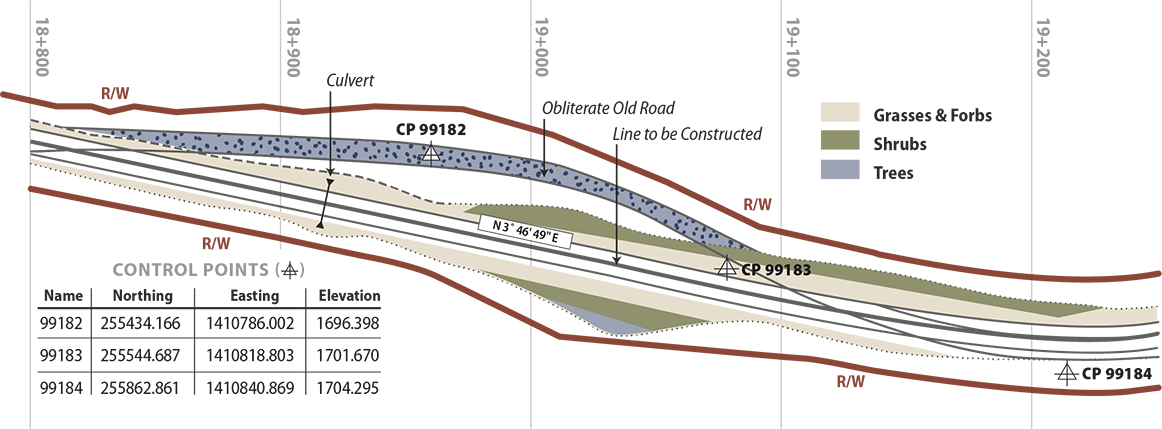
Figure 2-8 | Interpretation of plan view showing revegetation zones
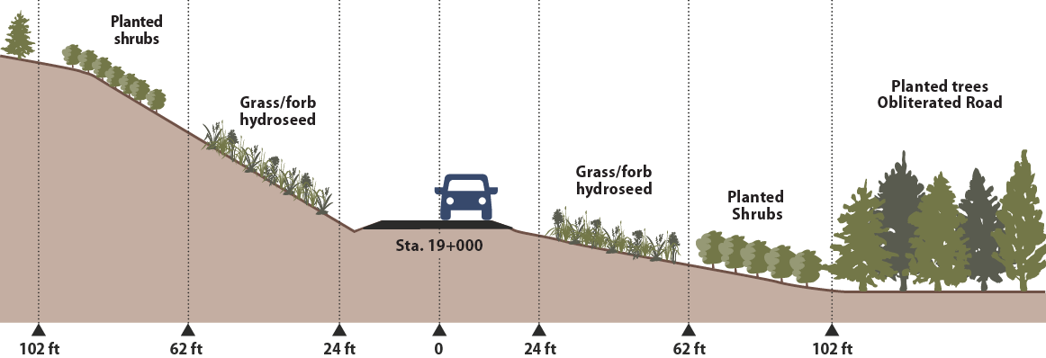
Figure 2-9 | Cross-section showing revegetation zones as interpreted from engineering plans